
News Summary
Middle Tennessee and Southern Kentucky are grappling with severe storms that have led to significant flooding, road closures, and emergency evacuations. Reports indicate trapped vehicles and rising water levels are causing urgent alerts from local authorities. As residents prepare for ongoing weather threats, including a tornado watch, safety measures and storm shelters have been implemented to protect those affected by the severe conditions.
Severe Storms Create Havoc in Middle Tennessee and Southern Kentucky
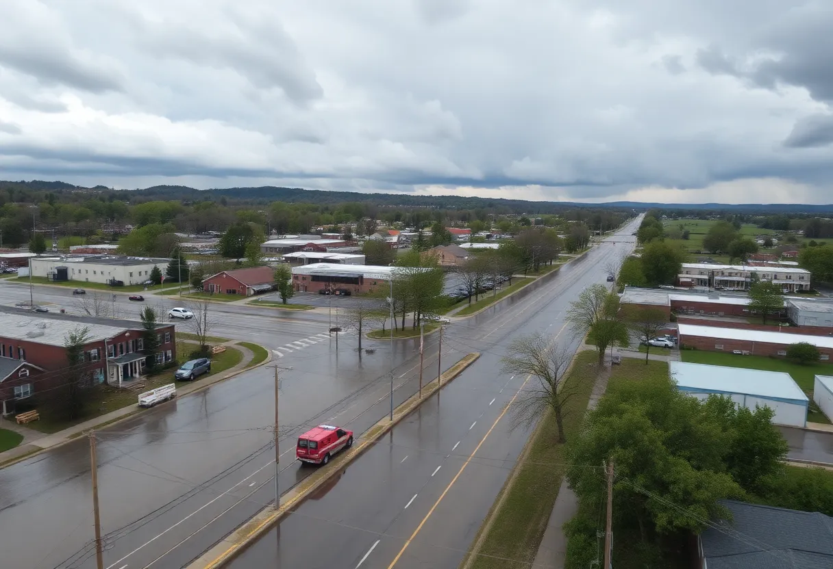
As the rain continues to pour down on Middle Tennessee and Southern Kentucky, residents are bracing themselves for serious weather conditions that are not just inconvenient but potentially dangerous. Flooding has become a significant concern, prompting emergency services across multiple counties to issue urgent warnings about high water levels on roadways.
Trapped and Treading Water
Reports have emerged of vehicles struggling to navigate flooded roads, with some even becoming stuck in deep water. A Flood Watch remains in effect for nearly all counties in Middle Tennessee and every Southern Kentucky county, extending from midnight Saturday through noon Sunday. Flash Flood Warnings, meanwhile, have been issued for areas north of I-40.
This additional rainfall is particularly troubling, as the ground was already saturated due to earlier storms earlier this week. In Simpson County, Kentucky, a water rescue was conducted as emergency services worked to help individuals trapped in rising water. The situation is equally dire in Lawrence County, Tennessee, and Warren County, Kentucky, where similar flooding problems have been reported.
Rainfall Quantities and Closures
By Saturday morning, it was reported that Simpson County had received between 1.5 to 3 inches of rain, forcing several roads to close. This has even led to the closure of the Simpson County Animal Shelter as access roads became impassable. In Montgomery County, floodwaters ravaged Cooper Creek Road, leaving it reduced to one lane after the embankment washed away.
The city of Clarksville felt the brunt of the storm too, accumulating several inches of rain, which raised alarms about potential flash flooding. Officials have been proactive, disseminating alerts about this alarming issue, and even evacuating the Palace Healthcare and Rehabilitation Center in Macon County due to imminent flooding risks. Patients were moved to local high schools as a precaution.
Road Conditions and Safety Measures
Henry County has not escaped the effects either, reporting multiple road closures, including the dramatic washout of Clifty Road. Local law enforcement agencies are on high alert, continually monitoring road conditions, and advising residents to stay off the roads during these perilous flash flood conditions.
Authorities have put together some important tips for safely navigating the roads during this emergency, urging drivers to consider safety above all. Flooded areas can be deceptive, and the best course of action is to avoid them altogether.
Tornado Risks and Warnings
Residents in Waverly, Waynesboro, and Clarksville are especially on edge, as they are likely to face the thick of peak dangers from midnight to 3 a.m. Sunday. With the ongoing storm, flash flood warnings have been extended due to worsening conditions throughout the evening.
Preparedness and Warnings
In response to the ongoing threats, an estimated 30 storm shelters and warming shelters have opened across the state for those seeking refuge. Clarksville reported a staggering 4 inches of rain from midnight until 2 p.m. Saturday, with more rain on the horizon.
Looking ahead, the Cumberland River at Clarksville is predicted to crest at 52 feet, triggering a new flood warning for Tuesday. This excessive runoff poses a significant risk, especially for the rivers, creeks, and streams, particularly north and west of Nashville. Notably, the Red River is among those rated most at risk.
Cheatham County has voiced the need for caution, as projections indicate the Cumberland River will rise sharply over the weekend. Officials are warning against driving through barricades or flooded areas, emphasizing that safety is always a priority.
Residents are strongly advised to prepare for the impacts of flooding on both land and property in the areas affected. Keeping updated with the latest forecasts, especially on river conditions, is key to staying safe and informed as the storm unfolds.
Deeper Dive: News & Info About This Topic
HERE Resources
Nashville’s Metro Employees Out-earn Mayor Amid Storm Warnings
In-N-Out Burgers to Open in Antioch, Nashville
Storm Delivers a Wild Ride Across Southern California
Middle Tennessee Prepares for Heavy Rain and Flooding
Southern California Faces Strongest Storm of the Season
California Braces for Major Rainstorm This Winter
Tennessee Faces Severe Weather Challenges as Hurricane Helene Hits
Winter Weather Alert: Two Major Storms Expected
Nashville Prepares for Floods and Snow This Weekend
Nashville Residents Reeling from Multiple Water Main Breaks
Additional Resources
- Tennessean: Weather and Flood Alerts for Nashville
- WSMV: Cumberland River Flooding Forecast
- WKRN: Flood Impacts on Roads in Middle Tennessee
- NewsChannel 5: Road Closures Due to Severe Weather
- WSMV: Flooding and Severe Weather Threat
- Wikipedia: Flood
- Google Search: Middle Tennessee Weather Alerts
- Google Scholar: Severe Weather in Tennessee
- Encyclopedia Britannica: Weather Flooding
- Google News: Middle Tennessee Severe Weather

Author: HERE Nashville
The NASHVILLE STAFF WRITER represents the experienced team at HERENashville.com, your go-to source for actionable local news and information in Nashville, Davidson County, and beyond. Specializing in "news you can use," we cover essential topics like product reviews for personal and business needs, local business directories, politics, real estate trends, neighborhood insights, and state news affecting the area—with deep expertise drawn from years of dedicated reporting and strong community input, including local press releases and business updates. We deliver top reporting on high-value events such as CMA Fest, Bonnaroo Music & Arts Festival, and Nashville Pride Festival. Our coverage extends to key organizations like the Nashville Area Chamber of Commerce and Nashville Health Care Council, plus leading businesses in healthcare, automotive, and technology that power the local economy such as HCA Healthcare, Bridgestone Americas, and Asurion. As part of the broader HERE network, including HEREBristol.com, HEREChattanooga.com, HEREKnoxville.com, and HEREMemphis.com, we provide comprehensive, credible insights into Tennessee's dynamic landscape.